
Delaware is facing another big storm this week with heavy rains and strong winds battering the area starting Tuesday afternoon and lasting through Wednesday.
A flood watch was issued by the National Weather Service on Sunday for the entire state of Delaware.

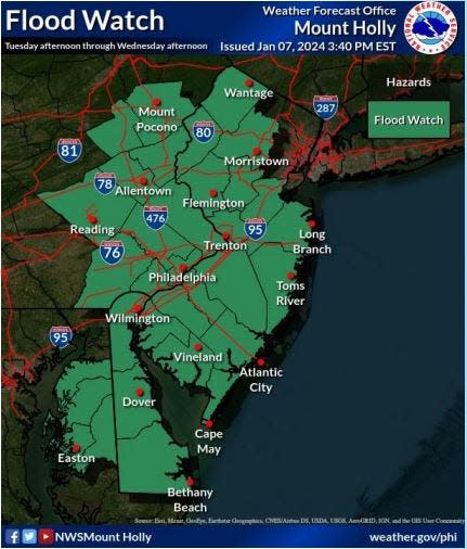 Flood Watch
According to the National Weather Service, the First State should expect between 1.5 inches and 3 inches of rain. The heaviest rain totals are predicted to hit southeastern Pennsylvania and northern New Jersey.

 Rainfall forecast
A coastal flood watch was issued for New Castle County. Spotty to moderate coastal flooding is expected from Fenwick Island to Wilmington.

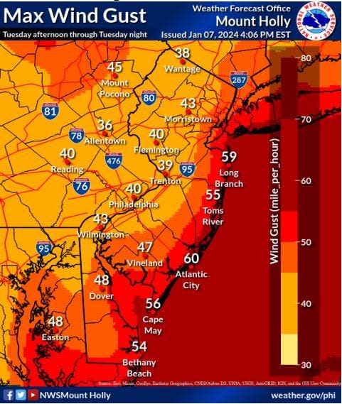 Wind gust forecast
Along with the heavy rains, the cold front will bring wind gusts ranging from 43 to 54 mph. The highest winds will be along the Atlantic Ocean and Delaware Bay. The winds will also bring dangerous seas building 15 to 20 feet on Tuesday night.
How to drive in heavy rains

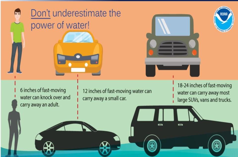 Flood Driving
Here are some tips on how to drive in a heavy rainstorm from AAA.com.
-
Avoid cruise control.
-
Reduce your speed and increase stopping distances.
-
Avoid flooded areas and don't try to drive through standing water.
-
Avoid hydroplaning and if you do start to skid, steer the car in the direction you want to go and avoid slamming the brakes.
This article originally appeared on Delaware News Journal: Flood watch issued for Delaware as storm forecasted for Tuesday